Note: Teapot Valley. The first 500 metres is through private property and access is currently denied, so please don't use this road to access the forest. There are signs at the gate.
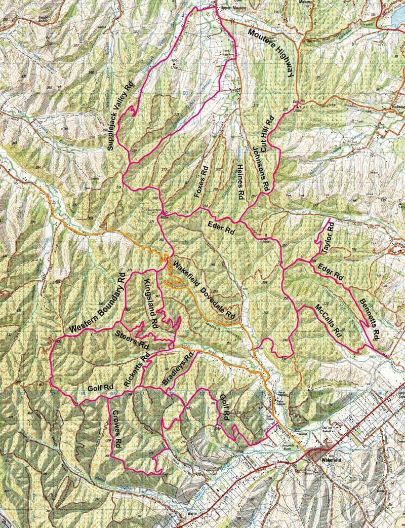
Entry points can be Upper Moutere, Eves Valley, Pigeon Valley or Hoult Valley.
From Upper Moutere you can ride up Supplejack Valley then complete a loop by dropping down Foxes, Heines or Johnsons Rd or else carry on out on Cut Hill Rd to the top of the Moutere Hill and ride back along the highway.
From Eves Valley, head up Taylor Rd, turn right on Eder Rd then next left and left again down McCalls Rd to Teapot Valley. Complete the loop along the road.
Various loops can be made from Pigeon Valley either by riding up the Dovedale Hill Rd and turning left on to Western Boundary Rd then hooking on to Golf Rd to drop down Ricketts, Bradleys or Golf back to Wakefield. Kingsland or Steers Rd can also be used to drop down to Pigeon Valley South Branch. Western Boundary Rd can be followed all the way out to the top of Spooners Range if you need to put some miles under your wheels. See also Hoult Valley ride.
From Teapot Valley head up past the Christian Camp and take either McCalls or Bennetts Rd to gain the ridge tops. There is a short loop if you head left at the top of McCalls back to Pigeon Valley or you can hook on to Eder Rd and follow it all the way around to the top of the Dovedale Hill.
Note: You may have to drag the window on your screen out wider to see all of the map below.