Rating: Grades 3-4
Know before you go: Weather on the Denniston Plateau can be quite miserable. The photos on this page were taken at Queens Birthday weekend when a freezing southerly was blowing. Be prepared.
Download PDF brochure and trail map: denniston-plateau.pdf
Getting there: Drive north from Westport and turn off to Denniston at Waimangaroa.
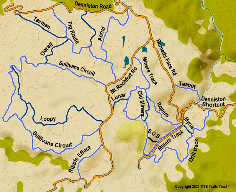
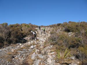
A number of the trails are on old bulldozed tracks that have weathered in the harsh environment
There is several hours of riding on the marked trails on the Denniston Plateau north-east of Westport. A brochure and map of the tracks is available at http://www.doc.govt.nz/parks-and-recreation/places-to-visit/west-coast/buller-area/denniston/activities/mountain-bike-tracks/ The map rates the trails as grade 3, however some of the technical sections would rate about 5, but can easily be walked. The slick rock underlying the area gives excellent traction and there are some good little uphill challenges.
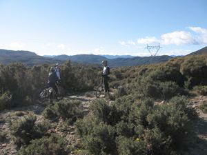
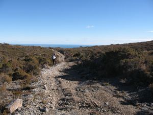
Pick your weather and you will get some amazing views
Grade 3: Intermediate
Distance: 3 km
Time: 20 minutes
This track is a quick and gentle introduction to the type of terrain found elsewhere at Denniston. You should be comfortable riding this track if you want to enjoy riding any of the others. Follow the red way-point track markers.
Ropers Hotel circuit
Grade 3: Intermediate
Distance: 5 km
Time: 30 minutes
This track has one marked technical section. Follow the orange way-point track markers.Note: Between point 2.1 and 2.2 is walking only - NO mountain biking on this section.
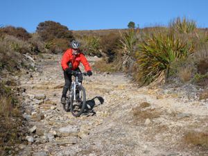
Rocky ledges on the Pig Route provide some technical interest
Miners Track circuit
Grade 3: Intermediate
Distance: 7 km
Time: 45 minutes
This track has four marked technical sections. Follow the purple way-point track markers.
Drill Track circuit
Grade 3: Intermediate
Distance: 8 km
Time: 1 hour
This track has eight marked technical sections. Follow the navy blue way-point track markers.
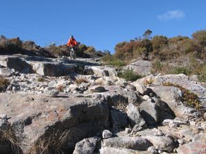
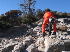
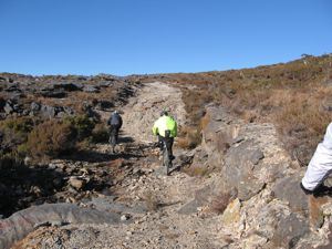
Alan found these ledges especially interesting. Nice landing though!
Pig Route circuit
Grade 3: Intermediate
Distance: 5 km
Time: 45 minutes
This track has six marked technical sections. Follow the blue way-point track markers.
Sullivans circuit
Grade 3: Intermediate
Distance: 9 km
Time: 1 hour
This track has three marked technical sections. Follow the green way-point track markers.
Whareatea circuit
Grade 3: Intermediate
Distance: 11 km
Time: 1 hour
This track has three marked technical sections. Follow the yellow way-point track markers.
NOTE: With Bathurst ramping up operations at Denniston they will be closing the Whareatea track as of July 1st 2014 until further notice.
Mt Rochfort Road
Distance: 17 km
Time: 1 hour 30 minutes up and 45 minutes down.This road is a 500 m vertical climb.
To Mt William - Mackley River - Buller Gorge
Distance: 27 km
Time: 4-8 hours via Cedar Creek Road.
This route is unmarked and because of the river crossings crossings must not be attempted during, or immediately after, rain. Refer Topomap sheet BR21 and route description ‘the Denniston Short Cut’ in Classic NZ Mountain Bike Rides by the Kennetts.This route passes through private land at the Inangahua end. The current status of the gate is that it is unlocked.