
Rating: Grade 3
Know before you go. The Dun Mountain Trail is a ride with a wilderness feel that can be ridden right from Nelson City. The trail surface is such that it can be ridden in most (but not extreme) weather. As Coppermine Saddle is at 870m always pack at least a windbreaker as conditions from Windy Point (which is not a misnomer), can be quite different to Nelson.
Getting there: From Nelson City head up Brook St and hook on to Codgers Trail (once it has been cleared after recent storms), which heads left off Brook St just before Betsy Eyre Park. Go all the way up Codgers on to the road up past the water treatment plant and continue straight ahead at the first intersection rather than up to Tantragee Saddle. It is well signposted.
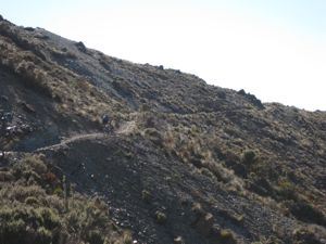
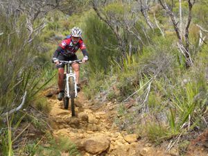
The track sidles across from Windy Point to Coppermine Saddle with only one short steep pinch
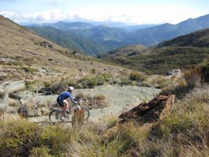
Well bermed switchbacks herald the start of the descent into the South Maitai Valley
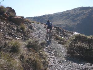
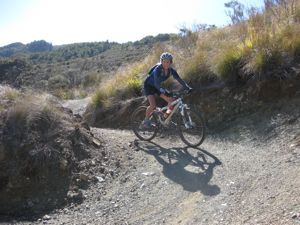
The track now sidles across the mountainside without much change in elevation to Coppermine Saddle from where you begin a long descent into the South Maitai Valley. This part of the track has steep sections with numerous switchbacks and a rough surface, loose in places that may be technically challenging for less experienced riders.
Sections of the old track compared to the new are like chalk and cheese.
Once down to the South Maitai the grade eases and a bridge takes you across the river for a blast out to the 4wd road. Beware of walkers on the trail at all times so stay under control. Follow the 4wd road until it swings right across the river. Go straight ahead here without crossing the river on to another single track, which follows the water supply pipeline.
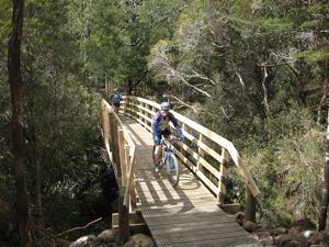
No more wet feet crossing the Maitai before you blast down the last section of singletrack
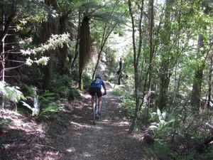
Keep on this track hugging the hill on an almost flat grade. Eventually the trail descends through bush with 3 or 4 switchbacks and drops you on the Maitai Valley Rd just below Smiths Ford Bridge. Bike down the road towards Nelson. Just before the Maitai Motor Camp cross a pipe bridge on your left that arches across the Maitai River and pick up the Maitai track that takes you all the way back to the city. It's a lot more pleasant than the road. Fit riders do this loop in under 3 hours, but allow up to 5 hours if you have a more relaxed pace and like to drink in the scenery. As this ride gets up into sub-alpine country it shouldn't be taken lightly. Make sure you have extra clothing, snacks and tools to repair your bike no matter what time of the year. Water is available from creeks along the way most of the time.